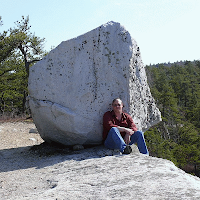
While it would be pretty cool if this were a dinosaur fossil, the age is entirely wrong. This is a rock unit known as the Austin Glen Formation and it's around 450 million years old from the Late Ordovician Period of geologic time. Dinosaurs didn't appear on Earth until 250 million years ago (the Early Triassic Period). This outcrop formed 200 million years before the age of the dinosaurs.
So, if it's not a dinosaur fossil, what is it? The short answer is flute casts - impressions of scours in the mud of seafloor sediments. The longer answer is more interesting.
Let's travel back in time to 480 million years ago which was the early part of the Ordovician Period. North America was smaller then, rotated about 90°, and straddling the equator. Geologists refer to proto-North America as Laurentia. What's now the Hudson Valley was a continental shelf on the south side of Laurentia in a sub-tropical climate zone (about 30° south latitude). This southern ocean was called the Iapetus (yes, I know the figure spells it "Iapetos", just a variation depending on how you want to transliterate the original Greek Ἰαπετός). Iapetus, mythologically, was the father of Atlas for whom the modern day Atlantic Ocean was named.
On this continental shelf seafloor that would later become the Hudson Valley, carbonate mud was accumulating much as it does today on the subtropical seafloor. This formed limestones in the Cambrian and Early Ordovician Periods (Wappingers Group carbonates here in the Hudson Valley). South of this, across a stretch of ocean, was a chain of volcanic islands (called the Taconic Island Arc by geologists). This chain of volcanic islands formed over a subduction zone - a place where two plates of oceanic crust collided, one slid down a seafloor trench beneath the other, and melting ensued providing magma for volcanic island formation.
Turbidity currents deposit thick beds of dirty sandstone (dirty, because it's not just pure quartz sand) called graywacke (from the German for "gray rock"). These graywacke sandstones often exhibit graded bedding where coarser particles are near the bottom of the bed and finer particles near the top because that's the sequence in which sediments will settle out of the turbidity flow (heavier, larger particles first, fine clays last). Deposits of deeper-water shales interbedded with thick beds of graywacke sandstone are called turbidites and represent multiple turbidity currents over long periods of time in an environment. An older name for turbidites are Bouma sequences proposed by geologist Arnold Bouma in 1962.
 Turbidity currents, as they move downslope, also scour out depressions in the underlying seafloor mud. These scours then fill with sand during the deposition of the graywacke beds forming bulbous projections on the bottom of the bed called sole marks (like the sole of your shoe). One type of sole mark are flute casts which are interesting because they indicate paleocurrent flow directions (generally, the scours have a long axis parallel the flow direction and are deeper on the upcurrent side and taper out on the downcurrent side).
The image at right (from Teaching Sedimentary Geology in the 21st Century) shows some typical flute casts where the paleocurrent direction was in the direction the fingers are pointing. The flute casts on the "dinosaur skin" outcrop are a bit more disorganized and sometimes referred to as mop structures because of their supposed resemblence to old string mops but formed in much the same way.
One other thing about the "dinosaur skin" outcrop. When looking at the vertical face of the outcrop, you're looking at the underside of the bedding plane because everything was folded here. This is because this rock, which once formed on the seafloor, was caught up in the mountain building event (called the Taconic Orogeny) when the volcanic island arc eventually collided with Laurentia. The rocks were thrust westward (northward then) on large thrust faults and everything was highly deformed and folded.
I think this story is just as interesting as the mistaken belief that this outcrop is a dinosaur skin impression. If you'd like to view this feature yourself, take the New York State Thuway to exit 21B for Coxsackie. Turn right onto Route 9W and about 1 mile up the road, on the left (west) side, is this outcrop (42° 24.348’ N, 073° 49.478’ W). There's plenty of room to pull over on the opposite side of the road. Please don't damage the outcrop, generations of geology students have stopped here and continue to do so each year.
I think this story is just as interesting as the mistaken belief that this outcrop is a dinosaur skin impression. If you'd like to view this feature yourself, take the New York State Thuway to exit 21B for Coxsackie. Turn right onto Route 9W and about 1 mile up the road, on the left (west) side, is this outcrop (42° 24.348’ N, 073° 49.478’ W). There's plenty of room to pull over on the opposite side of the road. Please don't damage the outcrop, generations of geology students have stopped here and continue to do so each year.


No comments:
Post a Comment